By: FlySafe Research

The scale and severity of GPS interference affecting commercial aviation has, according to a recent Aireon white paper, "increased and diversified significantly" over the last few years. Hundreds of flights worldwide now experience some form of GPS disruption on a daily basis. FlySafe analysis shows that understanding the mechanics of GPS jamming — and the distinction between jamming and spoofing — is essential for operators, dispatchers, and informed travelers navigating an increasingly complex global airspace environment.
How GPS Jamming Works
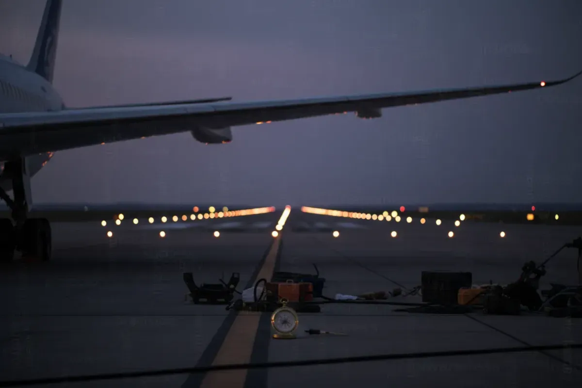
GPS signals are transmitted from satellites orbiting approximately 20,200 kilometers above the Earth's surface. By the time these signals reach a receiver — whether on the ground or aboard an aircraft — they are, as CRFS notes, "very weak." This inherent vulnerability is what makes jamming feasible.
GPS jamming is the intentional transmission of radio frequency interference on the same bands used by the Global Navigation Satellite System (GNSS). The jamming device overwhelms the legitimate satellite signals with noise, rendering the GPS receiver unable to calculate its position. According to Windward, GPS jamming is defined as "intentional interference with GPS signals to disrupt navigation and tracking."
The effect on an aircraft is immediate but, in most cases, recoverable. As Flightradar24 explains, "once the aircraft is no longer subject to GPS jamming, it will often resume sending its position." The disruption is temporary and geographically bounded — it persists only while the aircraft remains within the radius of the jamming source.
This stands in contrast to GPS spoofing, which represents a more insidious category of interference. Rather than simply blocking the signal, spoofing "sends false GPS data to an aircraft, with the goal of tricking the aircraft into thinking it's in a different location," as described by Spire. One documented incident, cited in the Aireon white paper, involved an aircraft traveling from Bangkok to Vienna that was subjected to GPS interference near the Black Sea, resulting in its position being falsely reported into Bulgaria, Hungary, and Ukraine.
Affected Routes and Regional Hotspots
GPS interference is not uniformly distributed. Certain regions have become persistent hotspots, and operators flying through these areas must maintain heightened situational awareness.
Airspace status — key regions of concern:
- Black Sea region. According to Flightradar24, GPS jamming is most prevalent "in the area around the Black Sea." Aircraft transiting between Europe and the Middle East or Central Asia are routinely affected.
- Middle East and Iraq. Spoofing events are "most common in areas of Iraq, around Ukraine and Russia, and most recently the eastern Mediterranean Sea," per Flightradar24's analysis. Spire has documented a "sharp increase in spoofing events over the Middle East and even in Polish airspace."
- Baltic region. Aireon recorded specific GPS interference incidents "between Dec. 25 and 26 with aircraft flying in the Baltic and Russian airspace."
- Eastern Mediterranean. This region has emerged as a newer area of concern, with increasing reports of both jamming and spoofing activity.
Affected routes include major east-west corridors between Europe and Asia, north-south routes over the eastern Mediterranean, and approaches to airports in the Middle East. These interference zones have, in documented cases, resulted in aircraft nearly entering restricted airspace — including, as Spire reported, incidents where aircraft came close to inadvertently entering airspace over Iran.
Flightradar24 has developed a dedicated GPS Jamming map that "clearly visualises current and historic patterns in GPS interference around the world," providing operators and analysts with a valuable situational awareness tool.
Aircraft Backup Systems and Operational Procedures
A critical point for understanding the real-world impact of GPS jamming on commercial flights: modern aircraft are not solely dependent on GPS for navigation. Multiple redundant systems exist, and flight crews are trained to employ them.
Inertial Reference System (IRS)
The primary fallback when GPS is unavailable is the Inertial Reference System. The IRS uses accelerometers and gyroscopes to track the aircraft's movement from a known starting position, calculating location through dead reckoning. However, as Spire notes, the IRS is "less reliable than GPS," and its accuracy degrades over time. In spoofing scenarios, the situation is further complicated because the "IRS tries to verify its position using the spoofed GPS data, often failing to detect the manipulation."
Non-GPS Navigational Aids
Ground-based navigational aids — VOR (VHF Omnidirectional Range), DME (Distance Measuring Equipment), and conventional ILS (Instrument Landing System) approaches — remain available and are entirely unaffected by GPS interference. At the February 2025 NBAA International Operators Conference, as reported by NBAA, it was recommended that aircraft use "only non-GPS navigational aids until systems are confirmed 'spoof free'" following an interference event.
ADS-B and Space-Based Surveillance
Automatic Dependent Surveillance–Broadcast (ADS-B) relies on GPS position data, meaning that ADS-B transmissions can themselves be corrupted during jamming or spoofing events. Aireon's space-based ADS-B system collects "billions of aircraft-transmitted ADS-B messages per day in real-time," enabling detection and visualization of GPS anomalies through its AireonVECTOR product suite, which can "detect and visualize GPS interference — such as jamming and spoofing — in real time."
Crew Training and Procedures
Airlines and flight crews are not caught off guard by these events. As Flightradar24 states, "Airlines and flight crews are aware... and are trained to use backup instrumentation when they experience it, ensuring the safe operation and completion of flights." Post-event procedures are also critical. Clément Meersseman of Nimbl, speaking at the NBAA conference, advised: "If you do run into a GPS spoofing situation, make sure that once you've completed your flight, you actually record it and log it so that the rest of the operation will find out how you dealt with it."
Emerging Detection and Mitigation Technologies
The aviation industry is actively developing countermeasures against GPS interference, spanning hardware, software, and procedural solutions.
Controlled Reception Pattern Antenna (CRPA) systems represent a hardware-level defense. As CRFS explains, CRPA technology combats jamming by shaping antenna reception beams to minimize interference and optimize satellite signal reception, creating "constructive interference" towards satellites and "destructive interference" towards the jamming source. When interference is detected, CRPA antennas "angle the beams toward the satellites while ignoring the GPS jamming signals."
Signal authentication techniques are also under development. According to APG, countermeasures include "signal strength monitoring, time-of-arrival analysis, and cryptographic authentication." Time-of-arrival analysis works by verifying that satellite signals arrive within expected time windows, flagging anomalies that could indicate a spoofing attempt.
Detection applications are being made available to operators. The Aircraft Performance Group has developed a free app called NaviGuard, designed to help pilots and dispatchers detect and mitigate GPS spoofing. APG describes it as a "free contribution to helping professional aviators maintain safe, reliable navigation in an era of evolving threats."
Crowdsourced reporting plays an increasingly important role. According to Windward, "the maritime and aviation industries share GPS disruptions to track jamming hotspots and identify patterns," creating a collective intelligence layer that complements technological solutions.
Recommendations for Operators
Based on publicly available NOTAMs, EASA Safety Information Bulletins, and industry best practices, the following operational recommendations apply:
- Pre-flight planning. Check current GPS interference reports for all FIRs along the planned route. Consult Flightradar24's GPS Jamming map and relevant NOTAMs for active interference zones.
- Route selection. Where operationally feasible, airlines have rerouted to avoid known interference hotspots. Alternative routing should be considered when transiting the eastern Mediterranean, Black Sea region, and Middle East corridors.
- In-flight response. If GPS degradation or anomalous behavior is detected, crews should revert to conventional navigation aids immediately. Do not attempt to re-engage GPS-dependent systems until clear of the affected area.
- Post-flight reporting. Document all GPS anomalies thoroughly — including time, position, altitude, and observed effects — and submit reports to the relevant aviation authority and operator safety management system.
- System verification. Following any suspected spoofing event, aircraft GPS and navigation systems should be verified as functioning correctly before being used for subsequent operations.
Key Takeaway
GPS jamming and spoofing represent a significant and growing operational consideration for commercial aviation, but they do not constitute an unmanageable safety risk. Modern aircraft carry multiple independent navigation systems, crews are trained to respond to GPS degradation, and the industry is deploying increasingly sophisticated detection and mitigation tools. The primary risk lies not in a single jamming event but in complacency — the failure to plan for, recognize, and report GPS interference when it occurs.
FlySafe continues to monitor GPS interference patterns across global airspace. Operators and aviation professionals are encouraged to consult current NOTAMs, EASA SIBs, and real-time interference mapping tools before and during operations in affected regions.
Analysis based on publicly available data only.
Frequently Asked Questions
Could a GPS jammer cause a commercial aircraft to crash?
GPS jamming alone is highly unlikely to cause a catastrophic outcome on a commercial flight. Modern aircraft carry multiple independent navigation systems, including inertial reference systems and ground-based navigational aids, that function independently of GPS. Flight crews are trained to recognize GPS degradation and revert to backup instrumentation. As Flightradar24 notes, airlines and crews are trained to ensure "the safe operation and completion of flights" during such events.
Where are the world's GPS interference hotspots?
The most persistent interference zones are concentrated around the Black Sea, the eastern Mediterranean, parts of Iraq, the Baltic region, and areas near the borders of several eastern European countries. Flightradar24 identifies the Black Sea area as the most prevalent zone for jamming, while spoofing is most common across Iraq, the eastern Mediterranean, and parts of eastern Europe.
What is the difference between GPS jamming and GPS spoofing?
Jamming blocks the GPS signal entirely by flooding the frequency band with noise, causing the receiver to lose its position fix. Spoofing is more sophisticated — it transmits false GPS data that tricks the receiver into calculating an incorrect position. As Spire explains, spoofing is considered more dangerous because the aircraft's backup systems, such as the IRS, may attempt to verify their position using the spoofed data and fail to detect the manipulation.
Can GPS jamming or spoofing affect a commercial passenger aircraft?
Yes, commercial aircraft can and do experience GPS interference. Hundreds of flights are affected daily across various regions. However, the aviation industry has multiple layers of redundancy and procedural safeguards in place. The operational impact typically involves temporary loss of GPS-derived position data, which crews manage through established procedures and alternative navigation systems.
Why do threat actors disrupt GPS signals?
According to Windward, GPS jamming is used for various purposes, including making it "more difficult for aggressors to target a certain area" and disrupting navigation and tracking systems. The interference, while often directed at specific operational objectives on the ground, inevitably affects civil aviation operating in the same airspace — a significant unintended consequence that the industry must manage through planning and awareness.
- GPS jamming temporarily overwhelms satellite signals with noise, causing receivers to lose position — but the disruption ends once the aircraft exits the jammer's range; spoofing is more dangerous because it feeds false position data rather than simply cutting the signal.
- GPS interference is geographically concentrated in specific hotspots like the Black Sea region, meaning route planning and dispatcher awareness are the first line of defense for operators.
Powered by B1KEY
Live tools behind the analysis.
The signals FlySafe writes about are also published live — continuously verified by the Sentinel pipeline.
Information is accurate as of the publication date. FlySafe uses exclusively publicly available data.