By: FlySafe Research
The Federal Aviation Administration is reviewing Wing Aviation's proposed expansion of commercial drone delivery operations in the Houston metropolitan area, a development that carries significant implications for low-altitude airspace management across one of the busiest aviation corridors in the United States. FlySafe analysis shows that the intersection of expanding drone delivery networks and existing manned aviation traffic in the Houston region warrants close attention from operators, dispatchers, and airspace planners alike.
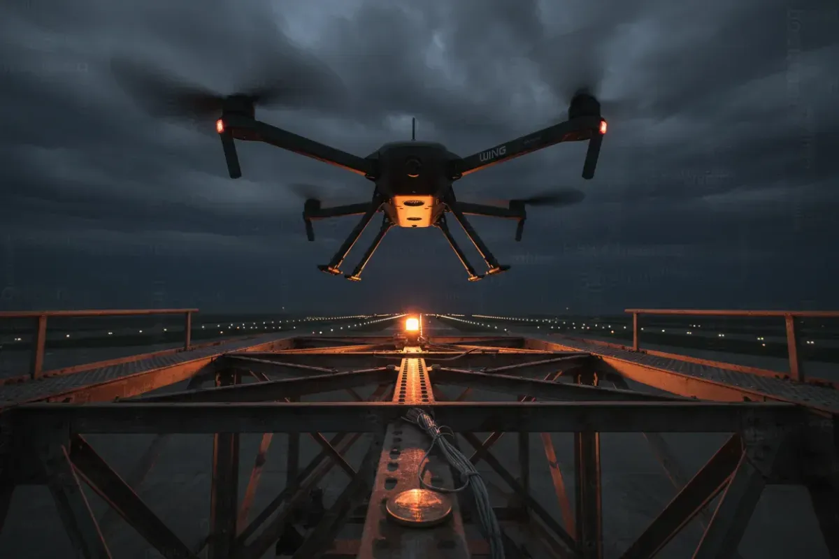
Wing Aviation, LLC holds a distinction as the first recipient of a 14 CFR Part 119 air carrier certificate with authority to operate unmanned aircraft systems under 14 CFR Part 135 as a single-pilot operator, awarded by the FAA in April 2019. The agency subsequently amended this authority in October 2019 to permit operations as a standard Part 135 operator. Wing's initial commercial operations involved delivering food and over-the-counter pharmaceuticals directly to homes in Christiansburg, Virginia, as part of the FAA's Integration Pilot Program. The proposed Houston expansion represents a considerable scaling of this operational footprint into a far more complex airspace environment.
Airspace Status: Houston's Low-Altitude Environment
Houston's airspace presents a uniquely challenging environment for drone delivery integration. The region is home to George Bush Intercontinental Airport (KIAH) and William P. Hobby Airport (KHOU), both operating within Class B airspace, along with numerous general aviation fields, heliports serving the region's extensive medical center complex, and a substantial volume of rotorcraft traffic associated with the energy sector.
Commercial drone delivery operations are conducted at low altitude — under 400 feet above ground level — in airspace where direct FAA air traffic services are not traditionally provided. According to the FAA's own documentation on package delivery by drone, Unmanned Aircraft System Traffic Management (UTM) systems are intended to enable "multiple drones operating under Beyond Visual Line-of-Sight (BVLOS) regulations at low altitude airspace (under 400 feet above ground level)," and the agency has acknowledged that "direct FAA air traffic services are not provided to these operations."
This operational reality places a premium on detect-and-avoid technology, Remote Identification compliance, and robust coordination between drone operators and conventional aviation stakeholders. For pilots operating in the Houston area — particularly those conducting low-altitude operations such as helicopter emergency medical services, news gathering, and offshore energy transport — awareness of expanding drone delivery corridors is essential.
Regulatory Framework Governing the Expansion
The FAA's regulatory approach to commercial drone delivery has undergone substantial evolution. As detailed by Crowell & Moring's analysis, the agency's proposed rulemaking represents a "significant shift" in how commercial drones may operate within the United States, moving away from a "case-by-case exemption framework" that previously limited widespread commercial activities. The central focus of this shift is enabling routine BVLOS operations — the capability that underpins any commercially viable drone delivery network.
Several regulatory requirements shape how Wing's Houston operations would function:
Remote Identification. As of 2025, all commercial drones must broadcast Remote ID data — including position, altitude, and velocity — every second. According to FreightAmigo's regulatory summary, this requirement applies universally to commercial UAS operations and serves as a foundational element of airspace awareness for both regulators and other airspace users.
BVLOS Authorization. Operators seeking Beyond Visual Line of Sight approval must submit a comprehensive safety case via the FAA portal, accompanied by evidence of detect-and-avoid capability. The FAA's proposed framework would require unmanned aircraft operating in higher-risk environments — specifically Class B and C airspace or Category 5 population areas — to be equipped with the means to detect and avoid non-cooperative aircraft. Houston's Class B airspace designation places Wing's proposed operations squarely within this elevated requirement tier.
Altitude Restrictions. The maximum operational altitude for drone delivery remains 400 feet AGL, with waivers available up to 10,000 feet MSL for specialized operations. Night operations are permitted under 2025 regulations, provided aircraft are equipped with position lights and the operator holds an appropriate FAA waiver.
Compliance Enforcement. The regulatory stakes are considerable. Penalties for non-compliance include fines of up to $75,000 per violation, along with the potential for certificate suspension — a consequence that could effectively halt an operator's entire commercial delivery program.
Environmental Review Process and Public Engagement
A critical component of the FAA's review involves compliance with the National Environmental Policy Act (NEPA). The agency must assess environmental effects before approving or amending operating authorities for drone delivery services.
The FAA has released a draft Programmatic Environmental Assessment (PEA) evaluating the potential environmental impacts of commercial drone package delivery operations conducted under Part 135 across the United States. As reported by the National Air Transportation Association, this assessment addresses requirements under NEPA and related federal environmental and historic preservation laws.
The environmental review process has proven to be a substantive checkpoint. According to DRONELIFE's analysis, most drone delivery approvals to date have proceeded through project-by-project Environmental Assessments, each of which "has resulted in a Finding of No Significant Impact." The programmatic approach now under consideration would potentially streamline future approvals by establishing a broader environmental framework applicable to multiple delivery sites.
The Houston area has already seen substantial public engagement on drone delivery environmental reviews. Public comments compiled by the FAA include submissions from the City of Missouri City, Texas — located within the Greater Houston metropolitan area — regarding a proposed drone delivery center. The City of San Marcos, Texas, submitted comments supporting "the responsible development of innovative technologies," while the City of Austin provided formal input on proposed drone delivery operations in Texas. These municipal responses illustrate the level of local government engagement that Wing's Houston expansion can be expected to generate.
Detect-and-Avoid Technology and Airspace Integration Challenges
The technical requirements for safe airspace integration in a region as complex as Houston represent perhaps the most significant operational challenge facing the expansion. The FAA's proposed rules would mandate that drones operating in Class B airspace be capable of detecting and avoiding non-cooperative aircraft — that is, aircraft not equipped with transponders or ADS-B transmitters.
This requirement has drawn scrutiny from multiple stakeholders. As noted in the Crowell & Moring analysis, some commenters on the FAA's proposed rule criticized the detect-and-avoid standards, voicing concern that the required technologies "could be prohibitively expensive" and have "not yet been proven effective or safe at scale." The FAA itself has acknowledged operational trade-offs, refraining from requiring ADS-B Out for manned operations below 500 feet in its Notice of Proposed Rulemaking due to "concerns about the financial and operational burdens such a requirement would impose."
This creates a notable gap in the cooperative surveillance environment at the very altitudes where drone delivery operations are concentrated. Without universal ADS-B equipage below 500 feet, drone operators must rely on alternative detection methods to maintain separation from manned aircraft — including helicopters, agricultural aircraft, and other low-altitude operators that may not carry cooperative surveillance equipment.
Affected routes in the Houston terminal area could include helicopter corridors serving the Texas Medical Center, offshore energy transit routes departing from Ellington Field and various heliports, and general aviation traffic patterns at facilities such as Sugar Land Regional Airport, Pearland Regional Airport, and numerous private strips throughout the metropolitan area.
Noise Considerations and Community Impact
Community noise impact represents a persistent concern in the environmental review of drone delivery operations. Research conducted at the Politecnico di Torino, as documented in a master's thesis on drone noise assessment, highlights that drones produce "high-frequency, tonal noise, which can be more annoying to people" compared to other noise sources of equivalent decibel levels. The research framework assessed whether indoor noise levels remain below 42 dB — the threshold recommended by the World Health Organization to prevent sleep disturbances — and provided guidance on determining minimum distances drones should maintain from residential buildings to meet this standard.
For Houston-area communities that may fall within Wing's proposed delivery corridors, these noise characteristics are directly relevant. Unlike conventional fixed-wing or rotorcraft traffic that passes through at higher altitudes, drone delivery operations involve repeated low-altitude transits over residential areas, with hovering phases during package lowering that concentrate noise exposure at specific locations.
The FAA's environmental review process is designed to evaluate these impacts and determine whether mitigation measures — such as operational hour restrictions, altitude minimums over residential areas, or designated transit corridors — are warranted. Based on publicly available NOTAMs and operational precedents from existing drone delivery sites, operators have typically implemented voluntary noise mitigation measures including restricted early morning and late evening operations.
Implications for Operators and Airspace Users
Recommendation: Pilots and operators conducting low-altitude operations in the Greater Houston metropolitan area should monitor FAA publications and NOTAMs for updates regarding the establishment of drone delivery corridors. The following operational considerations apply:
- Helicopter operators should anticipate the potential designation of drone delivery zones below 400 feet AGL in suburban areas of Houston, particularly in communities south and west of the city center where previous drone delivery environmental reviews have focused.
- General aviation pilots operating at uncontrolled fields in the Houston area should be aware that drone delivery traffic may be present in the vicinity of suburban residential areas, operating without direct ATC services.
- Flight training operations conducted at low altitudes in the Houston metropolitan area should incorporate awareness of potential drone delivery corridors into their operational risk assessments.
Airlines have rerouted or adjusted procedures in other metropolitan areas where drone delivery operations have been established, and similar procedural updates may be warranted as Houston's drone delivery infrastructure develops.
The Broader Regulatory Trajectory
Wing's Houston expansion does not exist in isolation. Amazon Prime Air has simultaneously sought FAA approval for drone delivery operations in the Houston area — specifically in Missouri City, Texas — as well as in Tolleson, Arizona, the Detroit metropolitan area (with four proposed delivery centers), and the Kansas City metropolitan area (with two proposed delivery centers). According to FAA documentation, the closest residential neighborhood to Amazon's proposed Tolleson facility is approximately 1,300 feet west of the site, illustrating the proximity of these operations to populated areas.
This parallel expansion by multiple operators underscores the urgency of establishing a coherent regulatory framework for low-altitude airspace management. The FAA's programmatic environmental assessment approach, if finalized, would provide a standardized framework rather than requiring individual assessments for each new delivery site — a change that could significantly accelerate the pace of approvals nationwide.
FlySafe analysis indicates that the Houston metropolitan area, given its complex airspace structure, high volume of conventional aviation activity, and the simultaneous interest of multiple drone delivery operators, will serve as a significant test case for the viability of large-scale drone delivery integration in major U.S. metropolitan airspace. Stakeholders across the aviation sector — from airline dispatchers to general aviation pilots to air traffic management professionals — should monitor developments closely and engage with the FAA's public comment processes as they become available.
Analysis based on publicly available data only. FlySafe Research provides airspace risk intelligence derived exclusively from publicly available, independently verifiable data sources published by international aviation authorities, academic institutions, and open-data projects.
Frequently Asked Questions
What is the maximum weight that Wing's delivery drones can carry?
Wing's delivery drones are designed for small commercial packages, consistent with the items delivered during the company's initial operations in Christiansburg, Virginia, which included food and over-the-counter pharmaceuticals. Specific payload capacity figures are determined by the aircraft's type certificate and operating limitations as approved by the FAA.
Will drone delivery operations create excessive noise in residential neighborhoods?
Drone noise is a documented concern in environmental assessments. Research has established that drones produce high-frequency, tonal noise that can be perceived as more annoying than other sources at equivalent decibel levels. The World Health Organization recommends indoor noise levels remain below 42 dB to prevent sleep disturbances, and the FAA's environmental review process evaluates whether proposed operations meet applicable noise thresholds.
What are the delivery hours and time windows for drone package delivery?
Delivery hours are determined through the FAA's environmental review and operational approval process. Night operations are permitted under current regulations with appropriate position lighting and an FAA waiver. Specific operating windows for Houston-area operations would be established as part of the approval process and documented in applicable NOTAMs.
How far can drones travel to deliver packages from each nest site?
Delivery range from each drone nest location depends on the specific aircraft type, battery capacity, payload weight, and weather conditions. Operators establish service areas as part of their operational approvals, and these areas are subject to FAA review to ensure compliance with airspace restrictions and environmental requirements.
- Houston's airspace is unusually hazardous for drone integration because it combines Class B airspace from two major airports with dense heliport, medical, and energy-sector rotorcraft traffic at the same low altitudes where drone delivery operates.
- Below 400 feet AGL, the FAA provides no direct air traffic services to drone operators — safety relies entirely on UTM systems, detect-and-avoid technology, and Remote ID compliance, not conventional ATC oversight.
- Wing Aviation holds a landmark regulatory position as the first drone operator certified under both Part 119 and Part 135; the Houston expansion scales this model from a small Virginia town into one of the most complex aviation corridors in the US.
Powered by B1KEY
Live tools behind the analysis.
The signals FlySafe writes about are also published live — continuously verified by the Sentinel pipeline.
Information is accurate as of the publication date. FlySafe uses exclusively publicly available data.