This case study documents an ongoing, publicly reported aviation safety issue. Data is sourced from EASA, EUROCONTROL, OPSGROUP, IATA, and open ADS-B networks.
GPS Interference
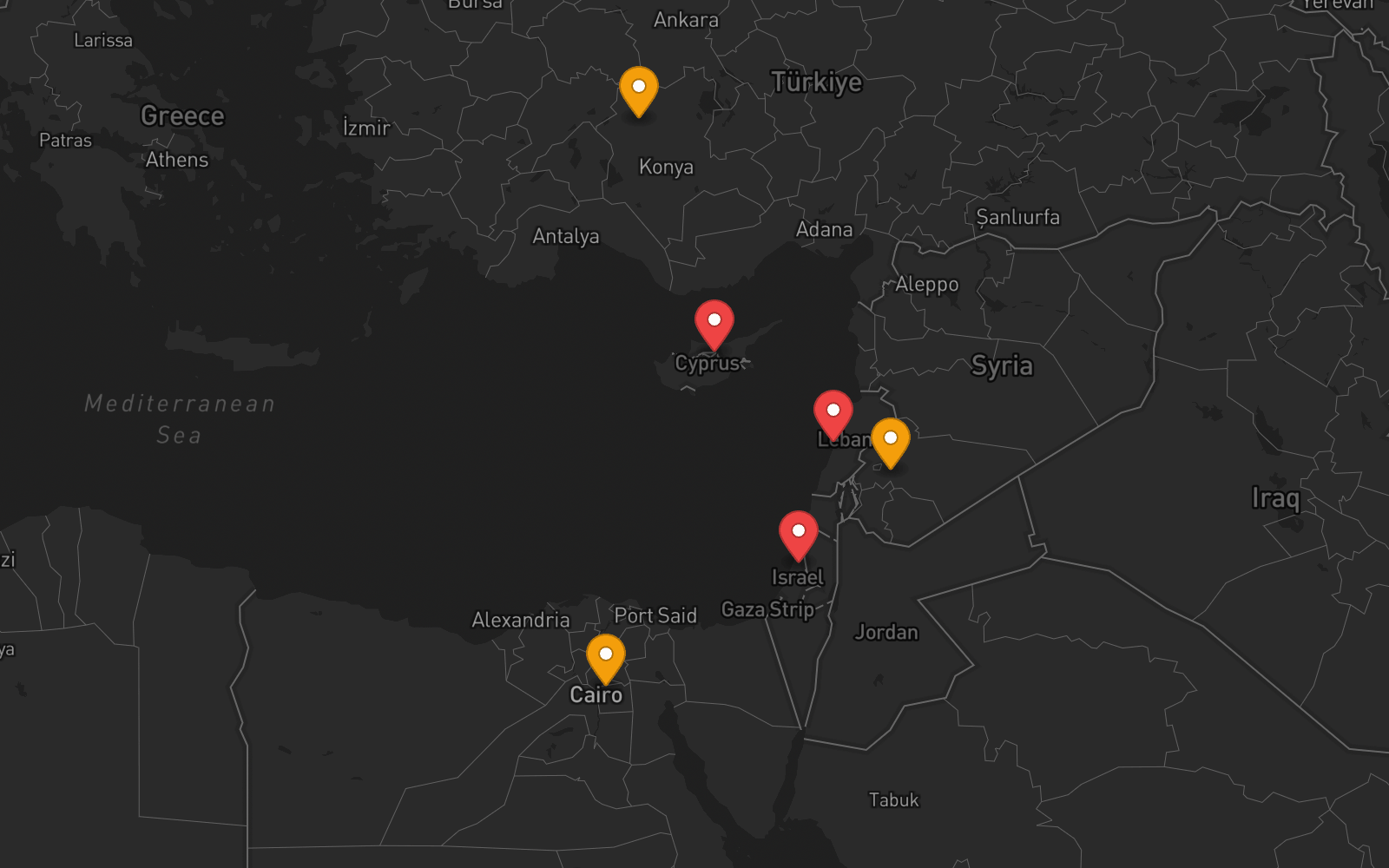
Eastern Mediterranean
An airspace closure is a road blocked with barriers — visible and absolute. GPS spoofing is a road with all the signs changed to show wrong destinations. Drivers proceed confidently toward the wrong place. In the Eastern Mediterranean, 1,500+ flights per day navigate with falsified position data. The airspace is open. The navigation lies.
Not a Closure — Something Worse
Every other case study in this series documents airspace closures — events where authorities shut down a region and all traffic stops. GPS interference is fundamentally different. The airspace remains open. Flights operate on normal schedules. There is no visible boundary to the threat.
- ATC prohibits entry
- Threat is known and bounded
- No flights enter the danger zone
- Risk is explicit
- Airspace open, flights proceed normally
- Threat acts inside navigation systems
- Aircraft enter with full ATC clearance
- Risk is invisible — no error flags
Jamming vs Spoofing
Two types of GPS interference — one visible, one not. The Eastern Mediterranean has both, but spoofing is the dominant and more dangerous threat:
Overpowers GPS signals. Receiver loses lock and displays "GPS unavailable."
Broadcasts counterfeit GPS signals stronger than real satellites. Receiver locks on and computes a confident wrong position.
The critical detail: A Gulfstream G650 departing Tel Aviv experienced complete navigation failure — FMS, IRS, and GPS all showed an incorrect position, 225 nautical miles from reality. Navigation systems designed to handle GPS loss cannot handle GPS actively lying.
Scale of the Problem
Eastern Mediterranean and Black Sea combined: over 1,000 daily flight disruptions. Globally: 41,000 flights affected in a single month (mid-July to mid-August 2024).
OPSGROUP documented a 500% increase in GPS spoofing incidents in 2024 vs prior year. IATA: 220% increase in GPS signal loss events between 2021 and 2024.
OPSGROUP survey of ~2,000 flight crew: 70% rated GPS spoofing safety concern as "very high or extreme." 91% rated concern moderate or higher.
EASA Safety Information Bulletin SIB 2022-02 (revised R3, July 2024). Lebanon banned GPS-based approaches at Beirut. But no airspace closures — the risk falls on crews to manage in real time.
Timeline
EUROCONTROL first documents GPS interference around Cyprus. Low-level, intermittent.
Reports jump from 154 (2017) to 4,364 — a ~2,700% increase over Cyprus. Feb 2020: one-fifth of Cypriot airspace flights affected in a single 3-hour period.
Russia invades Ukraine. GPS interference becomes a persistent feature of the Eastern European conflict. EASA issues original SIB 2022-02.
Step change. Large-scale electronic interference begins in the region, linked to regional conflict activity. Spoofing (not just jamming) becomes the dominant mode. First complete nav failures reported.
Turkish Airlines diverts from Beirut — crew unable to land after 40 minutes. Lebanon bans GPS-based approaches. 117 ships show false position at Beirut Airport simultaneously.
Lebanon files formal complaint with UN Security Council and ITU. EASA issues SIB 2022-02 R3. Eight countries affected simultaneously.
OPSGROUP publishes 120-page final report. 950 participants. 8 systemic safety concerns, 33 specific concerns. 70% of crews rate concern "extreme."
EASA and IATA publish joint comprehensive mitigation plan. Problem acknowledged at the highest regulatory level.
Ongoing. The interference persists as long as regional conflicts continue. No end date.
What Happens to a Flight
Aircraft enters spoofing zone. GPS receiver locks onto counterfeit signals broadcast from ground. No alert — receiver sees valid-looking satellite data.
FMS computes false position (commonly showing Beirut Airport or Cairo). FMS feeds this false position to IRS — contaminating the inertial backup system before anyone notices.
GPWS/TAWS generates false terrain alerts. ADS-B broadcasts wrong position to ATC and other aircraft. TCAS may generate phantom traffic conflicts. RNAV/RNP approach becomes unusable.
Crew notices discrepancy between GPS and visual references (if VMC) or between GPS and DME/VOR. Must abandon GPS navigation, request ILS approach, report position by ground reference. In IMC conditions — significantly harder.
Aviation Impact
IATA data: 580,000+ instances of GPS signal loss affecting ~18.4 million flights globally (Aug 2021–Jun 2024).
A G650 departing Tel Aviv: navigation systems showed the aircraft 225 nautical miles from actual position. FMS, IRS, and GPS all unreliable simultaneously.
April 2024: 117 ships appeared at Beirut Airport coordinates on GPS simultaneously. Same spoofing signals affect aircraft and maritime traffic.
The interference persists as long as regional conflicts continue. EASA/IATA joint plan focuses on mitigation — not on stopping the source.
Takeaway
GPS interference is not just a different threat — it's a different category of threat. Airspace closures are binary: open or closed. GPS spoofing is a spectrum of degradation that varies by location, altitude, time of day, and regional conflict activity. It requires continuous monitoring, not point-in-time NOTAMs.
The data exists: ADS-B quality metrics (NACp, NIC) from OpenSky Network and ADS-B Exchange detect interference in near real-time. GPSJam.org visualizes it daily. The problem is not data availability — it's that no aviation-focused system aggregates interference data with conflict signals, flight routes, and operational risk scores.
FlySafe monitors ADS-B quality degradation as a core signal category — alongside conflict data, satellite imagery, and official advisories. GPS interference zones are scored per-FIR and per-route, giving operators a continuous risk picture rather than relying on static advisories that say "interference possible" without quantifying when or where.
Sources
- OPSGROUP — GPS Spoofing Final Report (120 pages, September 6, 2024), 950 participants workgroup
- EASA — Safety Information Bulletin SIB 2022-02 R3 (July 5, 2024); GNSS Outages and Alterations page
- EASA + IATA — Joint comprehensive plan to mitigate GNSS interference risks (June 2025)
- IATA — Safety Risk Assessment on GNSS Interference V5; 580,000+ signal loss events data
- EUROCONTROL — GPS interference reporting, Cyprus analysis (2017–2021)
- GPSJam.org — Daily GPS interference map using ADS-B Exchange NACp data
- OpenSky Network — ADS-B sensor network, NACp/NIC quality metrics research
- NPR, CNN, Foreign Policy, Breaking Defense — GPS spoofing impact reporting
- Lebanon Civil Aviation Authority — GPS approach ban directive, UN/ITU complaint (July 2024)
All data sourced from publicly available reports, aviation safety bulletins, and open data platforms.
This case study documents an ongoing, publicly reported aviation safety issue. GPS interference data is sourced from EASA, EUROCONTROL, OPSGROUP, IATA, and open ADS-B networks. FlySafe's monitoring pipeline includes ADS-B quality metrics as a core signal category for interference detection.