By: FlySafe Research
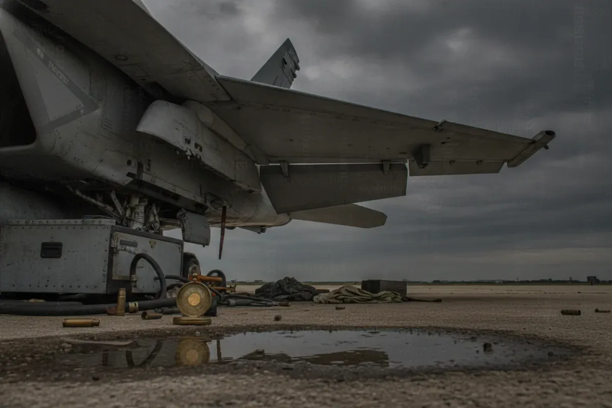
A US Marine Corps F/A-18D Hornet came down near Rimrock Lake in Washington state, with the pilot ejecting safely before the aircraft struck the ground. For aviation safety analysts, an event like this is not primarily a news item — it is an airspace event. A downed aircraft in mountainous terrain generates a recovery operation, temporary airspace restrictions, and a set of practical considerations for every other aircraft operating in the region. FlySafe Research reviews incidents of this type through a single lens: what changes for the airspace, and what operators should do about it. The following bulletin summarizes the publicly known facts and the standard procedures that typically follow.
Analysis based on publicly available data only.
Incident Summary
Airspace status: A US Marine Corps F/A-18D Hornet was reported down near Rimrock Lake, located in the Cascade Range west of Yakima, Washington, along the US Route 12 corridor. The pilot ejected and survived, which is the single most important fact in any account of an aircraft loss. The terrain in this area is forested and mountainous, with elevations rising sharply away from the lake, and is sparsely populated.
From an operational standpoint, the key data points are straightforward: one aircraft lost, crew recovered, and a ground site requiring securing and investigation. There is no indication in publicly available reporting of injuries on the ground. The aircraft type, the F/A-18D, is a two-seat variant of the Hornet, a twin-engine aircraft originally produced by McDonnell Douglas and later Boeing, and it is equipped with a through-the-canopy ejection system designed for survivability across a wide envelope of speed and altitude.
This region sits within airspace managed by Seattle Air Route Traffic Control Center (ZSE) and is used regularly by general aviation, mountain-flying traffic, and periodic training activity. Any disruption near Rimrock Lake therefore touches a mix of recreational, instructional, and transit flights rather than scheduled airline corridors.
Why the Ejection Outcome Matters
The headline detail — that the pilot ejected safely — reflects decades of engineering investment in crew survivability. Modern tactical aircraft of this generation use rocket-assisted ejection seats that can function across a broad range of conditions, including the low-altitude, adverse-attitude scenarios that are statistically the most dangerous. Martin-Baker, one of the principal manufacturers of such systems, maintains a long-running record of lives saved by its seats, and successful ejections continue to be added to that tally each year. The full record is documented publicly by the manufacturer through its Ejection Tie Club, which tracks confirmed survivable ejections.
A successful ejection changes the character of the entire event. Where the crew is recovered, the subsequent response is an investigation and a site-recovery operation rather than a search-and-rescue mission under time pressure. That distinction directly affects how surrounding airspace is managed: restrictions are oriented around protecting the wreckage site and supporting ground and rotary-wing recovery assets, not around an active rescue grid. For pilots planning flights in the vicinity, this typically means a defined, charted restriction rather than a rapidly shifting search area.
Airspace and NOTAM Implications
When an aircraft is lost over land, the responsible authorities commonly establish a Temporary Flight Restriction (TFR) over the site. In the United States, TFRs of this nature are issued by the Federal Aviation Administration under 14 CFR 91.137, which provides for restrictions in the vicinity of disaster and hazard areas to protect persons and property on the surface and to keep transiting traffic clear of recovery operations. These restrictions are published as NOTAMs and are the authoritative reference for any operator planning a route through the area.
Affected routes: The most directly affected traffic is low-level general aviation and any mountain-flying activity tracking the US Route 12 corridor and the Rimrock Lake basin. Scheduled airline traffic at high altitude is generally routed well above and clear of a localized surface-area restriction and is unlikely to require significant changes; the operational impact concentrates on lower-altitude regional and recreational flying.
Based on publicly available NOTAMs, operators should expect a defined-radius restriction centered on the wreckage site, extending from the surface up to a stated altitude, and remaining active until recovery and the on-site phase of the investigation are complete. The published NOTAM is the controlling document — its specific coordinates, radius, vertical limits, and effective times supersede any general expectation described here.
Recommendation: Pilots intending to operate near Rimrock Lake should check the FAA's official TFR listing and the NOTAM system during preflight planning and again immediately before departure, because restriction parameters around an accident site can be amended as the recovery progresses. Authoritative, real-time data is available through the FAA TFR list and the FAA NOTAM Search. Relying on these primary sources, rather than secondary reporting, is the standard professional practice.
Guidance for Pilots Operating Near Rimrock Lake
For general aviation and any operator planning to transit this part of the Cascades, the practical guidance follows established procedure:
Plan around the restriction, not through it
Build the route to remain clear of any active surface-area restriction laterally and vertically. In mountainous terrain, this can require additional planning, because the obvious low-level routes through valleys may coincide with the restricted basin. Identify alternate routings before departure rather than improvising near the boundary.
Expect rotary-wing and recovery traffic
Site-recovery operations frequently involve helicopters and low-level support flights. Even at the edges of a published restriction, pilots should anticipate increased low-altitude activity and maintain heightened visual scanning and radio awareness on the appropriate frequencies for the sector.
Treat NOTAM timing as dynamic
A restriction established for a recovery operation may be extended, contracted, or lifted as conditions change. Checking once during planning is insufficient. The most reliable approach is to verify the NOTAM status as close to departure as practicable and to remain ready to adjust if a restriction is amended en route.
Use primary data sources
Secondary accounts can lag behind or omit the precise parameters that matter for flight planning. The published NOTAM and the FAA TFR listing are the only sources that carry operational authority, and they should anchor every decision about whether and how to transit the area.
The Broader Safety Picture
A single airframe loss with a successful ejection is, in safety terms, the system working largely as intended on the survivability side. The investigative process that follows is where the durable value lies. Mishap investigations examine the full chain of contributing factors and feed findings back into maintenance practice, procedure, and design. That feedback loop is the mechanism by which individual events translate into fleet-wide risk reduction over time.
For the surrounding civil aviation community, the lasting lesson is procedural rather than dramatic. Localized airspace events are routine in the sense that the tools to manage them — TFRs, NOTAMs, and disciplined preflight verification — are mature and well understood. The risk to other operators is minimal when those tools are used as designed and significant only when they are ignored. FlySafe analysis shows that the majority of airspace-related incidents involving uninvolved aircraft trace back not to the original event but to inadequate preflight information, which is precisely the failure mode that consistent NOTAM checking eliminates.
Key Takeaway
The essential facts are clear and favorable: the pilot ejected safely, and the resulting airspace impact is a localized, manageable restriction over the Rimrock Lake site. For operators in the region, the correct response is procedural — verify the active NOTAMs and TFR status through primary FAA sources, plan to remain clear of the restricted area laterally and vertically, and anticipate low-level recovery traffic near the boundary. Scheduled high-altitude traffic is largely unaffected, while lower-level general aviation should plan with the published restriction firmly in mind.
FlySafe Research continues to monitor airspace status across regions affected by NOTAM restrictions and operational factors, translating raw advisories into clear, actionable guidance for flight planning. For ongoing airspace status updates, NOTAM-based route analysis, and structured pre-departure risk briefings, operators are encouraged to consult FlySafe.
Analysis based on publicly available data only.
- Современные катапультные кресла с ракетным ускорителем способны спасти пилота даже в наиболее опасных сценариях — на малой высоте и в нештатном положении самолёта; успешное катапультирование принципиально меняет характер всего инцидента: вместо поисково-спасательной операции следует расследование.
- Падение воздушного судна в горной местности автоматически влечёт введение временных ограничений воздушного пространства и восстановительную операцию, что напрямую затрагивает всех операторов в регионе — от авиации общего назначения до учебных рейсов.
Powered by B1KEY
Live tools behind the analysis.
The signals FlySafe writes about are also published live — continuously verified by the Sentinel pipeline.
Information is accurate as of the publication date. FlySafe uses exclusively publicly available data.